
 |
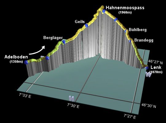
This is the eleventh stage of the Alpine Pass Route, crossing from Adelboden over the Hahnenmoospass to Lenk. After the last 3 high passes, this one at less than 2000m may seem remarkably low and grassy, with no rocky scree and no leftover snow (at least, not if you cross it in September!). But it still makes for a very scenic crossing from one valley to the other, with easy paths and plenty of rocky and snowy peaks in view.
For those tempted by shortcuts, you can take a gondola from Adelboden to Bergläger to cut out some of the climb, or take it further all the way up to Silleren and traverse across to the Hahnenmoospass from there. There is a gondola running up to the Hahnenmoospass itself from Geils, but that could reasonably be considered as cheating. If you were walking the Alpine Pass Route in the opposite direction (West to East) then you could use this gondola to save your knees from some of the descent, but then you could rent a Trottibike for that instead, which is probably a lot more fun.
Adelboden has a bus station with links down the scenic valley to Frutigen, which lies on the Kandertal line between Kandersteg and Spiez. Lenk has rail links to Zweisimmen, which in turn has links to Spiez.
From Zürich to Adelboden, you need a bus to Frutigen and the train from there through Spiez and Bern - the trip to Zürich takes around 3 hours and CHF 36 (assuming half-price card). From Lenk to Zürich you need to change at Zweisimmen and Spiez, with the journey taking between 3h and 3h30, and costing CH35. The last connection is currently around 8:30pm.
For Adelboden see adelboden.ch, and for Lenk see lenk.ch. A few minutes' walk out of the centre of Lenk is the Ökohof Schönegrund, which is recommended for its good value rooms, comfy lounge area and a very friendly welcome. If you wish to stay on the pass itself, see Berghaus Hahnenmoospass.
Adelboden - Bergläger - Geils - Hahnenmoospass - Bühlberg - Brandegg - Lenk
Hike time: | 4.5 to 5 hours |
Approx dist: | 14 km |
Start: | Adelboden bus station |
Finish: | Lenk station |
Profile: | from 1350m up to 1970m and down to 1070m |
Rating: | easy |
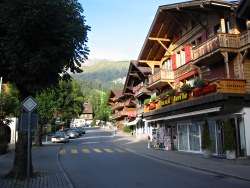
From the main bus station in Adelboden, there are signs to Hahnenmoospass and Lenk, leading along the main street of the village and past the
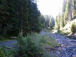
church. Just after the cable car station, the signs lead down a narrow lane to the left, down into the trees, to a track alongside the stream.
Follow the track upstream, until the signs point left up a path to cross a road underneath the gondola lines. From here you can just about
make out the grassy saddle of the Hahnenmoospass ahead.
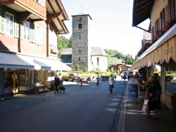
Main street in Adelboden
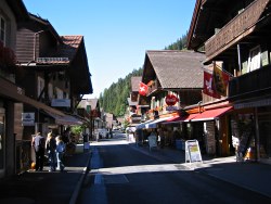
Main street in Adelboden
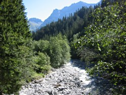
Mountain stream
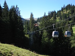
Following the gondolas to Bergläger
The path follows the gondola lines up towards Bergläger, around an hour from Adelboden, where there is a restaurant and the middle station of the gondolas. From here the gondolas turn right and ascend to Sillerenbühl, but our path carries on straight ahead, now on a paved road. This road is also used by the trottinets from Sillerenbühl and the occasional mountain board, but the footpath leaves shortly to the left on a footbridge over the stream.
Follow the track up alongside the stream, and take the signposted path up across the grassy slopes. There are plenty of opportunities to
sit on a bench admiring the views back down towards Adelboden and the valley beyond.
Track alongside stream
Looking back towards Adelboden
Approaching the gondola station at Geils
Climb up to meet the road, just below the lower gondola stations at Geils. Here, a signposted red-and-white path climbs up to the left, but
the more direct way just follows the road ahead to Geils (around 45 minutes from Bergläger), with the Hahnenmoospass directly ahead
in full view. A short distance up from Geils, a red-and-white signpost leads off to the right past a farm, climbing up to the left of
the gondola lines and following a winding track up to the ridgetop.
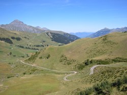
Looking back down the curving track
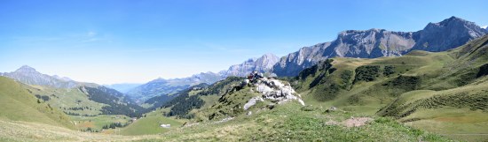
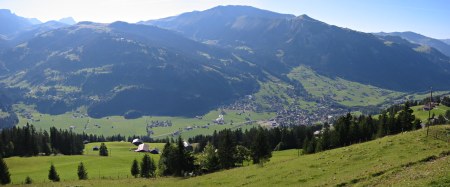
Panoramic view from the Hahnenmoospass towards Adelboden

View from Hahnenmoospass towards Lenk
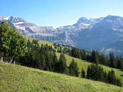
From this ridgetop, popular with model glider enthusiasts, there is a short diversion possible over to the Pommernpass to the left,
which offers views Southwards towards the Wildstrubel and the snow-covered peaks around. Or for those anxious to get to the Hahnenmoospass
itself, this is a short way over to the right, with a restaurant and views in both directions. This ideal lunch spot is reached in around
an hour from Geils.
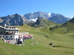
Restaurant on the grassy pass
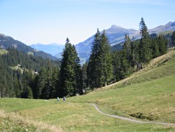
Track descending towards Lenk
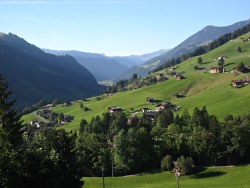
Lenk and the way up to the Trütlisbergpass
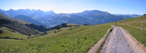
From the pass, a signposted track leads on a gentle descent towards Lenk. The Trütlisbergpass, the next pass on the Alpine Pass Route after this one, is clearly visible ahead as a v-shaped valley cut into the ridge beyond Lenk.
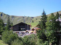
After around half an hour, you reach Bühlberg where there is another restaurant with a superbly-located terasse, with great panoramic views down to the valley.
The path leads on downward from Bühlberg, with occasional steep sections, down through the trees to reach Brandegg
after around 15 minutes.
Scenery on the descent
Grassy slopes above Lenk
Lenk centre
From Brandegg a track drops to the outskirts of Lenk, and the train and bus station is directly ahead. There are a variety of restaurants just round the corner from the station if you find yourself in need of calories.
For the next stage on the Alpine Pass Route over the Trütlisbergpass, see
Lenk to Lauenen.
The following are the coordinates for waypoints along this route, obtained from GPS. They can be used either in another GPS, or along with a map, to provide additional references if necessary.
                           Latitude       Longitude    Altitude(m)
       Adelboden Bus      N 46°29'36.2    E007°33'35.4    1348
       Rehärti            N 46°29'00.7    E007°32'37.1    1340
       Bergläger          N 46°28'07.6    E007°31'59.3    1486
       Geils              N 46°27'24.3    E007°30'47.9    1707
       Hahnenmoospass     N 46°27'11.9    E007°29'41.5    1956
       Lavey              N 46°27'10.5    E007°28'55.5    1830
       Bühlberg           N 46°27'12.4    E007°28'12.6    1661
       Brandegg           N 46°27'25.1    E007°27'51.0    1536
       Lenk station       N 46°27'28.0    E007°26'37.8    1068
For local information, see
adelboden.ch, including several useful panoramic maps,
and lenk.ch with its own panorama (700k pdf)
showing the Lenk side, and a pair of town maps.
Also the panorama at skigstaad.ch
shows a broad overview of this pass and the following ones. If you want to have a go of the Trottinet run from Sillerenbühl down to Bergläger,
have a look at silleren.ch vogellisiberg.ch. The Trottinet from either Hahnenmoospass or Sillerenbühl down towards Adelboden could be particularly
handy if you're doing the Alpine Pass Route in the West-to-East direction!