
Hike time: | 4 hours |
Start: | Oey-Diemtigen station |
Finish: | Oey-Diemtigen station |
Season: | All Year |
Profile: | from 670m up to 1170m, and back again |
Rating: | medium difficulty walk |
The Diemtigtal is a side-valley of the better-known Simmental, running Southwest away from Spiez. Right by the Niesen, this walk explores the valley floor, alongside the river, before climbing up to vantage points on the ridge. The views of the various valleys and peaks is fantastic, and the variety of pathways make this an interesting afternoon's walk.
Although this walk is quite low, the shady valley makes the snow last longer here than you might expect. The descent from Chilchflue to Diemtigbergli is not difficult, but because it's a narrow path along a steep hillside, some care will be required if the snow is deep or icy. Note that there is a fair amount of climbing required on this walk, notably between Chollerenbrügg and Chilchflue.
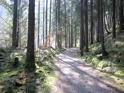 Path through the forest 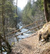 Path alongside the river 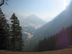 View up the Diemtigtal from Chilchflue 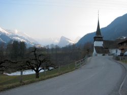 Church at Diemtigen |
The station Oey-Diemtigen is a few stops South of Spiez, on the line towards Zweisimmen. CHF 5 will buy you a return from Spiez, a 10 minute trip on the hourly regional train (the expresses don't stop at Oey-Diemtigen).
From Zurich you can take a direct train to Spiez, or change at Bern, either way it's around 2 hours each way. For a day return to Oey-Diemtigen you'll need CHF 53 and around 2h15.
For a zoomable, scrollable map of this hike, see this online map using Openstreetmap or Opencyclemap.
You can also download this kmz file diemtigtal.kmz to open it in programs like Google Earth or GpsPrune and then transfer the track to your GPS.
Oey - Horboden - Chollerenbrügg - Chilchflue - Bergli - Diemtigen - Oey
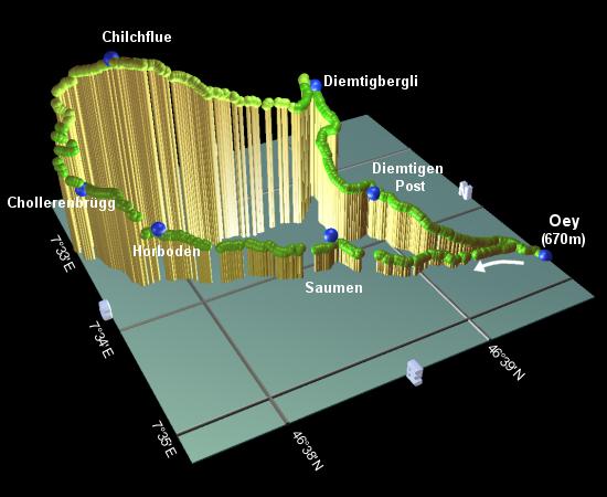 |
From the train station at Oey-Diemtigen, turn left following the signposts to Horboden, then left again at the main road, over the train tracks, and then right to meet a small stream. Turn left here, and follow the stream (and the signs to Horboden) to reach Saumen after around 35 minutes.
The path shortly climbs steeply over a crumbling ridge before dropping back down to the river again, reaching Horboden after around 30 minutes.
At Horboden, cross the road and take the small lane uphill signposted Diemtigbergli, shortly turning right and winding steeply uphill away from the river. The path then joins a wide track, which eases back downwards to meet the river again at Chollerenbrügg after around 25 minutes.
Cross over the bridge, and follow the main road for a short distance before taking the track up to the right, signposted Diemtigbergli. This path winds steeply up the ridgeside, between the trees, to reach the lookout point of Chilchflue after around 40 minutes. From here you can see right along the Diemtigtal valley, up towards the South, with clusters of snowy peaks into the distance.
From Chilchflue, follow the path still signposted Diemtigbergli, traversing the hillside and gradually descending. Some care would be required here under snowy or icy conditions, as the narrow path cannot be cleared or packed here. Eventually you will emerge from the trees onto a grassy shoulder on the corner of the ridge, with a whole expansive view suddenly appearing. Sweeping round from the Diemtigtal valley behind, along the Niesen ridge (barely recognisable from this angle), down the valley towards Spiez and the Thunersee, and around to the Stockhorn et al along the Simmental to the left, this spectacular panorama is only slightly spoiled by the concrete buildings forming the distant centrepoint. From here the path drops gently down to reach Diemtigbergli (or "Bergli") after about 50 minutes from Chilchflue.
Now following signs for Oey station, follow the road as it winds its way downhill, taking a track down to the village of Diemtigen. They are justly proud of their old buildings here, with a specially signposted route passing the most impressive and ancient houses. The carvings on the pillars, the ornate attention to detail, and the sheer size of the enormous overhanging eaves is incredible. Continue through the village to the post office, around 25 minutes from Bergli.
From here, keep following the signs to Oey station, dropping down not far from the outward route, and rejoining it by the stream. Continue through the village back to the station, around 25 minutes from Diemtigen Post.
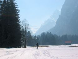
Wintry trail through valley in Zwischenfluh
The first part of this walk follows the so-called "Talweg", a footpath going along the whole length of the Diemtigtal. This walk follows a bus route fairly closely, giving the benefit of being able to stop the walk at any of several bus stops, and taking the easy way back to Oey. The only disadvantage is that the buses only run every two hours in either direction.
From Oey, the walk is identical as far as Chollerenbrügg, at which point the Talweg continues along the river, signposted to Schwenden. It closely follows both the river and the road, occasionally crossing both, and passing the base of the Wiriehorn ski area at Riedli. From there onwards the views improve and the packed path enters more open scenery further from the road. This stretch heads right for the icy peaks at the head of the valley, with a gentle but constant upward gradient (Tiermatten is some 180m higher than Riedli, and 300m higher than Chollerenbrügg).
The following are the coordinates for waypoints along this route, obtained from GPS. They can be used either in another
GPS, or along with a map, to provide additional references if necessary.
                           Latitude       Longitude    Altitude(m)
       Oey-Diemtigen stn  N 46°39'36.3    E007°34'43.5     669
       Saumen             N 46°38'39.7    E007°34'02.3     750
       Horboden           N 46°37'54.2    E007°33'38.4     815
       Chollerenbrügg     N 46°37'39.7    E007°33'10.1     871
       Chilchflue         N 46°37'53.8    E007°33'08.6    1168
       Diemtigenbergli    N 46°38'53.0    E007°33'13.4     993
       Diemtigen Post     N 46°38'56.5    E007°33'56.2     805
Again, sorry, no prizes for guessing diemtigtal.ch. There's also a free leaflet available, with a map of the whole area, called "Erhol Dich mal Diemtigtal", available in the post buses and at tourist information offices.