
 |
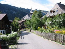
This is the thirteenth stage of the Alpine Pass Route, crossing from Lauenen over the Krinnenpass to Gsteig. By itself it's just a short walk over a low ridge, but it can be combined with the previous day over the Trütlisbergpass to make a reasonably challenging day. The walking here is fairly easy, with only a moderate up and down to contend with, and there are plenty of views to be enjoyed. Both Lauenen and Gsteig are very pleasant little villages, with all the typical Swiss houses and profusions of geraniums in the window boxes.
Note that the Krinnenpass is also signposted as Krinne, Chrine and as Chrinepass, but even so it's very very difficult to go wrong with the navigation.
Both Lauenen and Gsteig have bus connections to Gstaad, the transport hub of the area. From there there are train connections to Montreux and Zweisimmen.
From Zürich, these are long journeys - you need to change trains at Bern, and Spiez, and Zweisimmen, and Gstaad, before getting the bus up the side valley. The total trip to or from Zürich takes around 4 hours and CHF 39 (assuming half-price card).
For Lauenen and Gsteig see gstaad.ch or lauenen.ch. In Gsteig, the Hotel Bären has a nice site, and a friendly welcome.
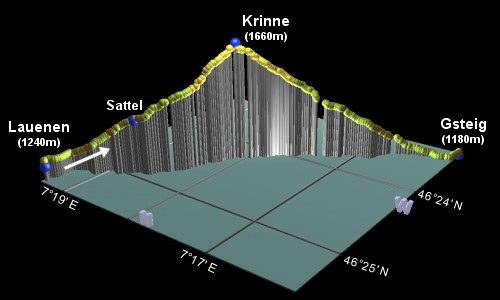
Lauenen - Krinnenpass - Gsteig
Hike time: | 2.5 hours |
Approx dist: | 7 km |
Start: | Lauenen bus station |
Finish: | Gsteig bus station |
Profile: | from 1240m up to 1660m and down to 1180m |
Rating: | easy-medium |
The post office (and therefore the bus stop for the post buses) is in the centre of the tiny village of Lauenen, with a signpost already pointing helpfully towards Gsteig. This leads through the main street of the village and before you know it you are heading out into the fields. You can quickly see that the pass coming up on this stage is not one of the wild, rocky ones, this one has even got trees on the top!
A short distance along the road, a signpost leads down a path to the right, dropping briefly before crossing a stream and beginning
to climb. As you gain height, you can look back towards Lauenen, nestled comfortably in the folds of the green valley.
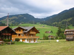
Busy bustling Lauenen
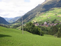
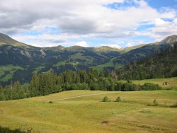
Lauenen nestled in the valley
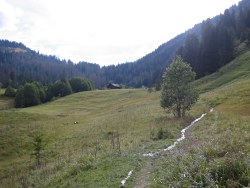
Wet path climbing towards the tree-covered pass
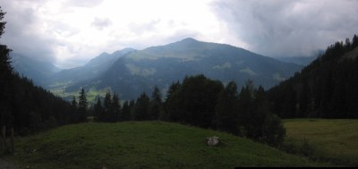
View back towards Hahnenmoospass
The path leads through the trees, with a few switchbacks, and climbs steadily with views back towards Lauenen and the
Hahnenmoospass. After around 1h20, you should reach the summit of the Krinnenpass, where you emerge from the trees through a
gate. Here there's a perfectly-positioned bench from which to admire the views down to Gsteig and the hills beyond.
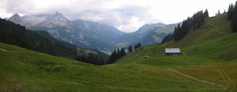
View from Krinnenpass towards Gsteig
Descent towards Gsteig
Path winding down to Gsteig
From the pass, you can look down towards Gsteig, and the gentle grassy descent ahead. Contemplating the course of the Alpine Pass Route beyond Gsteig, you can see that the route cuts round to right before climbing round the right-hand side of the triangular hump.
An easy track leads down the grassy slopes, leading to a road with paths making occasional shortcuts between the loops.
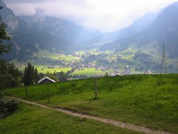
Shortly a path leads down beside a small stream to emerge at the edge of Gsteig village, where a signpost labelled "Gsteig/Post"
leads straight out onto the main road through the valley. Here turn left to find the Post office (and bus stop) a short
distance beyond the Hotel Viktoria on the right-hand side, and the rest of Gsteig village beyond that.
Looking back up towards the Krinnenpass
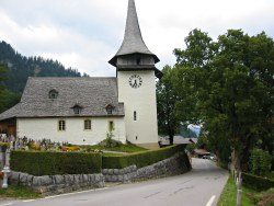
Church in Gsteig
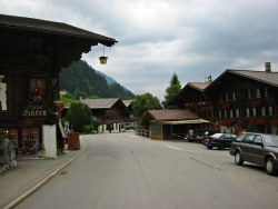
Main street in Gsteig
Here in Gsteig, they may start speaking French to you, for the first time on this Alpine Pass Route, so beware. Although still in Canton Bern, and although it has a very German-sounding name, Gsteig is located right at the edge of the German/French speaking border, so fellow walkers and locals will use either or both languages in an attempt to confuse you.
By the way, the apple pie at the Hotel Bären is highly recommended, making the perfect after-hike pick-me-up. With cream.
For the next stage of the Alpine Pass Route over the Blattipass and the Col des Andérets to Les Mosses, see
Gsteig to Les Mosses.
The following are the coordinates for waypoints along this route, obtained from GPS. They can be used either in another GPS, or along with a map, to provide additional references if necessary.
                           Latitude       Longitude    Altitude(m)
       Lauenen bus stop   N 46°25'26.6    E007°19'21.3    1241
       Sattel             N 46°24'56.2    E007°18'42.8    1400
       Krinne             N 46°24'15.8    E007°18'04.5    1659
       Gsteig bus stop    N 46°23'11.8    E007°16'03.1    1180
For local information, see lenk.ch and gstaad.ch. The panorama at skigstaad.ch shows a broad overview of this pass and the neighbouring ones.